Signing on the Dotted Line: Picking the Right Scanning Partner
Let's set the stage: you are an estimator or a preconstruction manager looking to fulfill the laser scanning line in your bidding documents. Or perhaps an owner or engineer trying to move a project forward with less uncertainty. Or an architect seeking an accurate base to begin laying out some space configurations. Or you are a… I could keep going because, if there's one thing I've learned during my career in AEC, it's that every project stakeholder can benefit from scanning data.
Accuracy, clarity, predictability, true as-built conditions… music to your ears, I know! But how do you navigate technology options and providers to achieve that peace of mind? And how do you ensure your project needs get properly translated into a purchase order if you don't speak the reality capture language?
In this two-part series, I’ll help you navigate the process of hiring laser scanning services, from choosing the right provider in Part 1 to signing the right proposal in Part 2 (coming soon).

Image generated with ChatGPT
Part 1: Picking the Right Scanning Partner
Allow me to start this piece with two uncomfortable truths:
First, the reality capture industry has no time to spare. When project teams realize scanning is needed, it’s usually already late. Second, scanning fees can feel all over the place depending on who you talk to, with similar projects receiving completely different price tags. If you are the one signing on the dotted line, that combination of urgency and uncertainty can feel like a heavy lift. Been there.
Most scanning requests I see stem from two scenarios: the project is already underway and teams are still waiting for reliable existing conditions, delaying coordination kickoffs, or something in the field simply doesn’t fit because the base model wasn’t accurate enough. While I see large general contractors increasingly incorporating laser scanning proactively into planning and scheduling, mid-size and smaller firms still tend to approach it reactively.
Under this pressure, the question is no longer whether scanning is needed, but what is fair to pay and who can deliver it correctly. At that point, selecting a provider stops being just procurement and becomes a project decision.
After years of hiring and vetting laser scanning companies, these are the main factors I look for when evaluating providers for my projects.
1. Technology
Whether hardware requirements are already defined in the bidding documents or you find yourself staring at a blank canvas, selecting the right technology can make or break a project. In practice, scanning providers rely on different types of hardware, each suited to specific project conditions and intended outcomes. Here are the most common categories: the first three types below are the most common in our industry, while the last two are technologies I have had the opportunity to use on select projects.
Terrestrial Scanning
Ground-based laser scanning performed from fixed positions using tripod-mounted scanners to capture highly detailed and accurate 3D data. This remains the most established approach in the AEC industry. It is particularly effective for above-ceiling documentation and, when combined with proper survey control techniques, enables extremely high levels of accuracy, especially on large-scale projects.*Learn about a case study where I applied terrestrial scanning for a large facility here.
Mobile/SLAM (Simultaneous Localization and Mapping)
Mobile scanning technology where an operator walks through a space carrying a handheld or backpack-mounted device that continuously maps the environment while tracking its position in real time. This approach is highly efficient in environments with heavy pedestrian or equipment traffic, such as manufacturing facilities, since it is significantly less disruptive to ongoing operations. While SLAM-based capture typically achieves lower accuracy than static terrestrial scanning, continuous hardware and algorithm improvements have significantly narrowed the gap, as demonstrated by solutions such as the NavVis scanners (VLX & MLX).Drone Scanning
Reality capture performed using sensors mounted on drones to collect aerial data (imagery or LiDAR) across large areas, rooftops, or hard-to-access locations. This approach enables rapid capture of vast amounts of data, though operations may be limited by airspace restrictions and site regulations. It is particularly well suited for civil infrastructure and large-scale outdoor projects.GPR (Ground Penetrating Radar)
Subsurface scanning used to detect utilities and hidden conditions beneath floors, pavements, and soil. It sends electromagnetic waves into the ground and analyzes reflections to locate buried objects or material changes. Widely used in renovation and excavation work to mitigate subsurface risk.
Sonar Scanning
Sonar-based technology used to map underwater environments where optical or laser scanning is not viable. It captures submerged structures, riverbeds, ports, and offshore assets. Essential for marine and hydraulic projects with limited visibility.
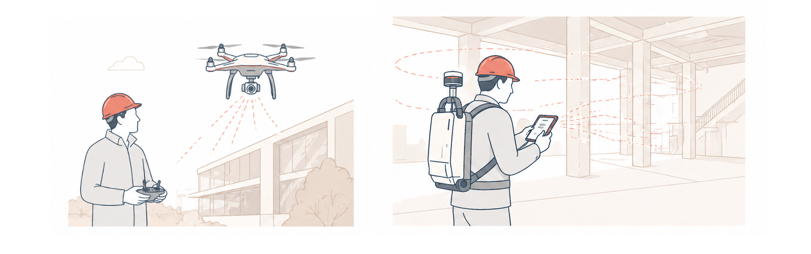
Image generated with ChatGPT
2. Experience
I’ve heard far too many sales representatives claim their companies have scanned every type of project imaginable. And while it may seem as simple as showing up with a scanner and capturing the space around you, reality capture involves a wide range of planning, access, and site logistics considerations that vary significantly depending on the project type.
Hazardous materials, containment cart management, safety training, extensive PPE requirements, OSHA certifications, vaccination protocols, and data security management are just a few examples.
My recommendation is simple: ask providers about the real-world difficulties they’ve faced on projects similar to yours. This helps confirm they have the right experience and can properly anticipate and manage project risks.
Consider the following items as food for thought when evaluating providers for your specific project type:
Above-ceiling scanning: How do they handle spaces with dense concentrations of pipes, conduits, and ducts that leave limited room for the equipment to pass through?
Outdoor projects: How do they manage adverse weather conditions such as rain and snow?
Active construction or demolition environments: How do heavy foot traffic and vibration affect their data quality?
Reflective materials: How do mirrors, metal piping, or standing water impact scan accuracy and coverage?
Heavy machinery areas: How do they capture equipment that cannot be fully documented from eye level?
Roof access limitations: Can they coordinate lifts, ladders, or specialized safety planning when required?
Sensitive control rooms: How do they manage spaces with computers and monitors displaying confidential information that cannot be turned off?
Hospital settings: How do they protect patient records or other confidential information that may be exposed during scanning?
Below raised-floor scanning: Do they have the proper equipment or supports to position the scanner upside down?
Crawl spaces: How do they operate in areas with extremely limited lighting and restricted mobility?
Dense vegetation: How do they handle obstructed sightlines during topographic capture?
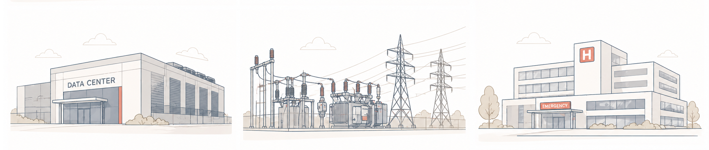
Image generated with ChatGPT
3. Scanning Strategy
Beyond understanding and accounting for the project constraints mentioned above, an ideal scanning partner should be able to explain, even at early stages, how they plan to approach the project and clearly outline the deliverables they can produce.
Here are a few practical considerations that can help you determine whether a provider is truly prepared for your project:
Can they secure scissor lifts or ladders if none are available on site?
How will they access very tall ceilings that require scanning from elevated positions?
Can they take care of removing ceiling tiles? What percentage needs to be removed?
Can they accommodate night shifts or weekend work if needed to avoid operational disruptions? Are there additional associated costs?
If the project requires multiple scanning phases to capture construction progress, how do they ensure consistent alignment between datasets?
Do they provide survey control services, or can they integrate the existing control network from another party?
If multiple capture methods are required (terrestrial and drone scanning, for example), how do they integrate different data sources?
Can they produce the type of deliverables your project actually needs?
Do they offer secure data hosting accessible to project stakeholders? Is this included, or does it come at an additional cost?
4. Miscelaneous
Last but not least, here are a few additional aspects I consider important when selecting a scanning provider:
Availability: How quickly can they mobilize?
Pricing structure: How is their work priced: hourly, daily, or per project scope?
Expenses: Do they charge mobilization expenses separately as reimbursables?
Change orders: How do they manage scope changes once the project is underway?
Deliverables: In what file formats can they export the scanned data?
Accuracy: What level of accuracy can they confidently guarantee?
Team capacity: Do they have a sufficient staff to fast track schedules on large-scale projects?
Insurance compliance: Can they meet the project’s insurance requirements and provide certificates promptly? This can absolutely delay the project start. Ask me how I know.
Final Thoughts
I trust the recommendations above are useful and that you keep them handy when speaking with potential vendors. You may notice that many companies hesitate to provide pricing on the spot. That’s because laser scanning involves a wide range of uncertainties and risks that must be evaluated before committing to a number.
The more detail you include in your RFPs, the better positioned providers will be to prepare accurate and reliable proposals, while making it much easier for you to compare options on an apples-to-apples basis.
Just remember: data alone doesn't move a project forward. The right provider should show up already thinking ahead about execution, coordination, and downstream use.
In Part 2 of this series, I’ll explore what a strong laser scanning proposal should include, helping ensure you sign the dotted line with peace of mind. Stay tuned!